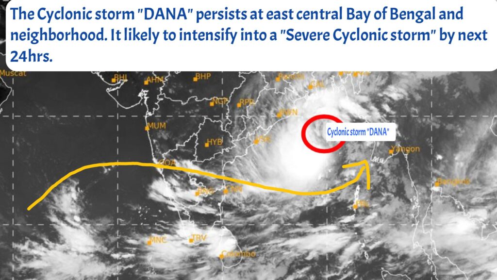
The cyclonic storm “DANA” persists at east central Bay of Bengal and neighborhood. It likely to become a severe cyclonic storm during next 24 hrs. It continues to move north-northeast direction and cross the coasts between north odisha “Puri” and “Sagar Islands” of West Bengal by late night hours of 24th oct, 2024 as a severe cyclonic storm.
Sundarbans of West Bengal (Sagar Island) likely to get high impact from this system by tomorrow (24.10.2024) night hours. Due to unfavorable wind shear & influence of Arabian ridge system may see drastic weakening once it make the landfall.
There is no direct impact for Tamil Nadu from this system, but as it nears the coasts. “Dana” will bring temporary westerly flow over southern peninsular India. It likely to bring hot & humid day conditions and thunderstorm rains during evening/night hours for next 3-4 days. From tomorrow, we have to look on west for the thunderstorm rains.
North coastal Tamilnadu including Chennai & KTCC belt, Delta, central & south Tamilnadu. Most of the districts will see thunderstorm rainfall activity during 24th to 26th Oct.
Thunderstorm rains are expected to reduce gradually from 27th Oct, simultaneously fog/mist activity will increase gradually on the same period.
